Tag: hurricane ida

  • Death toll tops 40 after Ida’s remnants blindside Northeast

    Death toll tops 40 after Ida’s remnants blindside Northeast

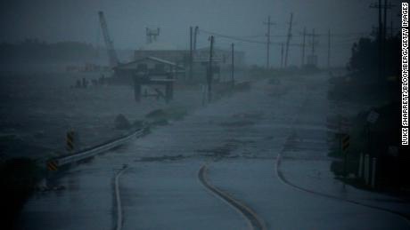
    A stunned U.S. East Coast faced a rising death toll, surging rivers and tornado damage Thursday after the remnants of Hurricane Ida walloped the region with record-breaking rain, drowning at least 46 people in their homes and cars.

    In a region that had been warned about potentially deadly flash flooding but hadn’t braced for such a blow from the no-longer-hurricane, the storm killed people from Maryland to Connecticut on Wednesday night and Thursday morning.

    At least 23 people died in New Jersey, Democratic Gov. Phil Murphy said. At least 13 people were killed in New York City, police said, 11 of them in flooded basement apartments, which often serve as relatively affordable homes in one of the nation’s most expensive housing markets. Suburban Westchester County reported three deaths.
    — Read on apnews.com/article/northeast-us-new-york-new-jersey-weather-60327279197e14b9d17632ea0818f51c

    We were warning people for several days about this potential development. It’s amazing to consider that now the death toll in the Northeast has topped the death toll from hurricane Ida in Louisiana as it hit with category 4 ferocity. 

  • Horror after Hurricane Ida: Man attacked by alligator in flooded Louisiana waters!

    Horror after Hurricane Ida: Man attacked by alligator in flooded Louisiana waters!

    Hurricane Ida has destroyed homes, left millions without power and killed at least two people. But perhaps most ominous, it’s brought danger in the water that’s flooding into communities. 

    Officials say a man was attacked by an alligator in some of those flooded Louisiana waters Monday. The man’s wife witnessed the attack that happened near the city of Slidell, which is just across Lake Pontchartrain from New Orleans, Jason Gaubert, a spokesman for the St. Tammany Fire District No. 1, told USA TODAY. 

    Gaubert said the attack took the man’s arm off and his wife went to call for help. When she returned, he had disappeared in the flood waters. The man’s body hasn’t been recovered and officials were investigating. 
    — Read on www.usatoday.com/story/news/nation/2021/08/30/hurricane-ida-man-attacked-alligator-flooded-louisiana-waters/5660363001/

  • New Orleans residents who evacuated get a message: Don’t come back yet

    New Orleans residents who evacuated get a message: Don’t come back yet

    The city of New Orleans is telling residents who evacuated ahead of Hurricane Ida to not return until further notice due to power outages and other damage.

    NOLA Ready, the city’s emergency preparedness office, sent a text alert to residents around 11 a.m., ahead of an 11:30 a.m. press conference from Mayor LaToya Cantrell.

  • New Orleans may face ‘weeks of darkness’

    New Orleans may face ‘weeks of darkness’

    New Orleans may be without power and air conditioning for more than three weeks in the wake of Hurricane Ida, which roared ashore with more powerful winds than Hurricane Katrina, according to utility owner Entergy Corp.

    Almost 750,000 homes and businesses were without power across Louisiana as of 7:26 p.m. local time on Sunday, according to Poweroutage.us, which tracks utility outages.

    The blackouts were concentrated in the southeastern tip of the state that includes New Orleans and where Ida made its U.S. landfall.

  • The mighty Mississippi reverses while battling  Evil Ida

    The mighty Mississippi reverses while battling Evil Ida

    Storm surge and strong winds from Hurricane Ida stopped the flow of the Mississippi River near New Orleans on Sunday and actually caused it to reverse — something the US Geological Survey says is “extremely uncommon.

    “Ida made landfall near Port Fourchon, Louisiana, early Sunday afternoon as an extremely dangerous Category 4 hurricane with winds of 150 mph, the National Hurricane Center (NHC) said.

  • All of New Orleans loses power

    All of New Orleans loses power

    All Orleans Parish customers without power due to “catastrophic transmission damage,” according to Entergy New Orleans.

    A company spokesperson said the storm had caused a “load imbalance to the company’s transmission and generation” and that Entergy is “making every effort to identify and rectify.”

    Now focus is on flooding and also the pumps in the Big Easy..

  • Hurricane Ida makes landfall.. gas prices nationwide set to increase

    Hurricane Ida makes landfall.. gas prices nationwide set to increase

    More than 95% of the Gulf of Mexico’s oil production has been shut down thanks to Hurricane Ida, regulators said Sunday, indicating the hurricane is having a significant impact on energy supply.  

    As of 11:30 a.m. CT, personnel have been evacuated from a total of 288 oil-and-gas production platforms, according to the Bureau of Safety and Environmental Enforcement. That represents about 51% of the manned platforms in the Gulf of Mexico.

    The agency said all 11 rigs in the Gulf of Mexico have also been evacuated, and a total of 1.7 million barrels of daily oil production in the Gulf of Mexico has been shut-in – the equivalent to 95.7% of the region’s total output. 
    — Read on www.cnn.com/us/live-news/hurricane-ida-updates-08-29-21/

    Ida has made landfall in Port Fouchon just about exact time the 16th anniversary of Katrina..

    Gas prices, as in 2005, are expected to immensely soar as a result of Ida ..

  • Ida unleashes hell

    Ida unleashes hell

    BREAKING: HURRICANE IDA FORECAST TO PRODUCE RECORD BREAKING STORM.SURGE IN PORTIONS OF LOUISIANA.

    A lethal 12-16′ storm surge is now forecast to impact portions of Louisiana…while 2 feet or more of rain is expected to fall.

    Ida will likely go into the record books as the worst storm to hit Louisiana and one of the most violent hurricanes to.ever hit the U.S.

    There are already countless reports of power outages, and other effects from Ida even before landfall at this hour.

  • CATASTROPHE LOOMING FOR GULF COAST

    CATASTROPHE LOOMING FOR GULF COAST

    This is beginning to be a striking similarity to Hurricane Katrina–if not worse..16 years to the exact date of when the storm struck New Orleans..

    THE LATEST WEATHER WARNING FROM NHC:

    WTNT24 KNHC 272041
    TCMAT4
    
    HURRICANE IDA FORECAST/ADVISORY NUMBER   6
    NWS NATIONAL HURRICANE CENTER MIAMI FL       AL092021
    2100 UTC FRI AUG 27 2021
    
    CHANGES IN WATCHES AND WARNINGS WITH THIS ADVISORY...
    
    A STORM SURGE WARNING HAS BEEN ISSUED FROM EAST OF ROCKEFELLER
    WILDLIFE REFUGE LOUISIANA TO THE MISSISSIPPI/ALABAMA BORDER
    INCLUDING VERMILION BAY...LAKE BORGNE...LAKE PONTCHARTRAIN...AND
    LAKE MAUREPAS.
    
    A HURRICANE WARNING HAS BEEN ISSUED FOR THE COAST OF LOUISIANA FROM
    INTRACOASTAL CITY TO THE MOUTH OF THE PEARL RIVER...INCLUDING LAKE
    PONTCHARTRAIN...LAKE MAUREPAS...AND METROPOLITAN NEW ORLEANS.
    
    A TROPICAL STORM WARNING HAS BEEN ISSUED FOR THE NORTHERN GULF
    COAST FROM THE MOUTH OF THE PEARL RIVER TO THE MISSISSIPPI/ALABAMA
    BORDER. A TROPICAL STORM WARNING HAS ALSO BEEN ISSUED FOR THE COAST
    OF LOUISIANA FROM WEST OF INTRACOASTAL CITY TO CAMERON.
    
    SUMMARY OF WATCHES AND WARNINGS IN EFFECT...
    
    A STORM SURGE WARNING IS IN EFFECT FOR...
    * EAST OF ROCKEFELLER WILDLIFE REFUGE LOUISIANA TO THE 
    MISSISSIPPI/ALABAMA BORDER
    * VERMILION BAY...LAKE BORGNE...LAKE PONTCHARTRAIN...AND LAKE
    MAUREPAS
    
    A HURRICANE WARNING IS IN EFFECT FOR...
    * CUBAN PROVINCES OF PINAR DEL RIO AND ARTEMISA...AND THE ISLE OF
    YOUTH
    * INTRACOASTAL CITY LOUISIANA TO THE MOUTH OF THE PEARL RIVER
    * LAKE PONTCHARTRAIN...LAKE MAUREPAS...AND METROPOLITAN NEW ORLEANS
    
    A STORM SURGE WATCH IS IN EFFECT FOR...
    * SABINE PASS TO ROCKEFELLER WILDLIFE REFUGE LOUISIANA
    * MOBILE BAY
    
    A HURRICANE WATCH IS IN EFFECT FOR...
    * CAMERON LOUISIANA TO WEST OF INTRACOASTAL CITY LOUISIANA
    * MOUTH OF THE PEARL RIVER TO THE MISSISSIPPI/ALABAMA BORDER
    
    A TROPICAL STORM WARNING IS IN EFFECT FOR...
    * CUBAN PROVINCES OF MATANZAS...MAYABEQUE...AND HAVANA
    * CAMERON LOUISIANA TO WEST OF INTRACOASTAL CITY LOUISIANA
    * MOUTH OF THE PEARL RIVER TO THE MISSISSIPPI/ALABAMA BORDER
    
    A TROPICAL STORM WATCH IS IN EFFECT FOR...
    * MISSISSIPPI/ALABAMA BORDER TO THE ALABAMA/FLORIDA BORDER
    
    A STORM SURGE WARNING MEANS THERE IS A DANGER OF LIFE-THREATENING
    INUNDATION...FROM RISING WATER MOVING INLAND FROM THE
    COASTLINE...DURING THE NEXT 36 HOURS IN THE INDICATED LOCATIONS.
    FOR A DEPICTION OF AREAS AT RISK...PLEASE SEE THE NATIONAL WEATHER
    SERVICE STORM SURGE WATCH/WARNING GRAPHIC...AVAILABLE AT
    HURRICANES.GOV.  THIS IS A LIFE-THREATENING SITUATION.  PERSONS
    LOCATED WITHIN THESE AREAS SHOULD TAKE ALL NECESSARY ACTIONS TO
    PROTECT LIFE AND PROPERTY FROM RISING WATER AND THE POTENTIAL FOR
    OTHER DANGEROUS CONDITIONS.  PROMPTLY FOLLOW EVACUATION AND OTHER
    INSTRUCTIONS FROM LOCAL OFFICIALS.
    
    A HURRICANE WARNING MEANS THAT HURRICANE CONDITIONS ARE EXPECTED
    SOMEWHERE WITHIN THE WARNING AREA.  A WARNING IS TYPICALLY ISSUED
    36 HOURS BEFORE THE ANTICIPATED FIRST OCCURRENCE OF
    TROPICAL-STORM-FORCE WINDS...CONDITIONS THAT MAKE OUTSIDE
    PREPARATIONS DIFFICULT OR DANGEROUS.  PREPARATIONS TO PROTECT LIFE
    AND PROPERTY SHOULD BE RUSHED TO COMPLETION.
    
    A TROPICAL STORM WARNING MEANS THAT TROPICAL STORM CONDITIONS ARE
    EXPECTED SOMEWHERE WITHIN THE WARNING AREA WITHIN 36 HOURS.
    
    A STORM SURGE WATCH MEANS THERE IS A POSSIBILITY OF LIFE-
    THREATENING INUNDATION...FROM RISING WATER MOVING INLAND FROM THE
    COASTLINE...IN THE INDICATED LOCATIONS DURING THE NEXT 48 HOURS.
    
    A HURRICANE WATCH MEANS THAT HURRICANE CONDITIONS ARE POSSIBLE
    WITHIN THE WATCH AREA.  A WATCH IS TYPICALLY ISSUED 48 HOURS
    BEFORE THE ANTICIPATED FIRST OCCURRENCE OF TROPICAL-STORM-FORCE
    WINDS...CONDITIONS THAT MAKE OUTSIDE PREPARATIONS DIFFICULT OR
    DANGEROUS.
    
    A TROPICAL STORM WATCH MEANS THAT TROPICAL STORM CONDITIONS ARE
    POSSIBLE WITHIN THE WATCH AREA...GENERALLY WITHIN 48 HOURS.
    
    INTERESTS ELSEWHERE ALONG THE NORTHERN U.S. GULF COAST SHOULD
    MONITOR THE PROGRESS OF THIS SYSTEM.  INTERESTS IN THE DRY TORTUGAS
    SHOULD ALSO MONITOR THE PROGRESS OF IDA.
    
    HURRICANE CENTER LOCATED NEAR 22.1N  83.2W AT 27/2100Z
    POSITION ACCURATE WITHIN  20 NM
    
    PRESENT MOVEMENT TOWARD THE NORTHWEST OR 320 DEGREES AT  13 KT
    
    ESTIMATED MINIMUM CENTRAL PRESSURE  985 MB
    MAX SUSTAINED WINDS  70 KT WITH GUSTS TO  85 KT.
    64 KT....... 20NE   0SE   0SW   0NW.
    50 KT....... 40NE  30SE   0SW  20NW.
    34 KT....... 80NE  60SE  40SW  60NW.
    12 FT SEAS..  0NE 120SE  45SW   0NW.
    WINDS AND SEAS VARY GREATLY IN EACH QUADRANT.  RADII IN NAUTICAL
    MILES ARE THE LARGEST RADII EXPECTED ANYWHERE IN THAT QUADRANT.
    
    REPEAT...CENTER LOCATED NEAR 22.1N  83.2W AT 27/2100Z
    AT 27/1800Z CENTER WAS LOCATED NEAR 21.6N  82.7W
    
    FORECAST VALID 28/0600Z 23.5N  84.8W
    MAX WIND  85 KT...GUSTS 105 KT.
    64 KT... 20NE  15SE  10SW  20NW.
    50 KT... 40NE  30SE  20SW  40NW.
    34 KT...100NE  80SE  50SW  90NW.
    
    FORECAST VALID 28/1800Z 25.3N  86.9W
    MAX WIND 105 KT...GUSTS 130 KT.
    64 KT... 20NE  20SE  15SW  20NW.
    50 KT... 40NE  40SE  30SW  40NW.
    34 KT...110NE  90SE  60SW 100NW.
    
    FORECAST VALID 29/0600Z 27.1N  89.0W
    MAX WIND 115 KT...GUSTS 140 KT.
    64 KT... 30NE  25SE  20SW  30NW.
    50 KT... 50NE  50SE  30SW  50NW.
    34 KT...130NE 100SE  70SW 110NW.
    
    FORECAST VALID 29/1800Z 28.6N  90.6W
    MAX WIND 120 KT...GUSTS 145 KT.
    64 KT... 30NE  25SE  20SW  25NW.
    50 KT... 50NE  50SE  40SW  40NW.
    34 KT...120NE 110SE  70SW  90NW.
    
    FORECAST VALID 30/0600Z 30.0N  91.3W...INLAND
    MAX WIND  80 KT...GUSTS 100 KT.
    50 KT... 40NE  40SE  30SW  20NW.
    34 KT...100NE 100SE  60SW  70NW.
    
    FORECAST VALID 30/1800Z 31.5N  91.1W...INLAND
    MAX WIND  40 KT...GUSTS  50 KT.
    34 KT... 50NE  90SE  30SW  30NW.
    
    EXTENDED OUTLOOK. NOTE...ERRORS FOR TRACK HAVE AVERAGED NEAR 150 NM
    ON DAY 4 AND 175 NM ON DAY 5...AND FOR INTENSITY NEAR 15 KT EACH DAY
    
    OUTLOOK VALID 31/1800Z 34.4N  89.3W...INLAND
    MAX WIND  30 KT...GUSTS  40 KT.
    
    OUTLOOK VALID 01/1800Z 36.0N  86.0W...POST-TROP/REMNT LOW
    MAX WIND  20 KT...GUSTS  30 KT.
    
    REQUEST FOR 3 HOURLY SHIP REPORTS WITHIN 300 MILES OF 22.1N  83.2W
    
    INTERMEDIATE PUBLIC ADVISORY...WTNT34 KNHC/MIATCPAT4...AT 28/0000Z
    
    NEXT ADVISORY AT 28/0300Z
    
    $$
    FORECASTER BROWN
    
  • Fear that Ida could strike as Cat 3

    Fear that Ida could strike as Cat 3

    Tropical Storm Ida swirled toward a strike on Cuba on Friday showing hallmarks of a rare, rapidly intensifying storm that could speed across warm Gulf waters and slam into Louisiana as a Category 3 hurricane on Sunday, the National Hurricane Center warned.

    “The forecast track has it headed straight towards New Orleans. Not good,” said Jim Kossin, a senior scientist with The Climate Service.

    Ida posed a relatively low threat to tobacco-rich western Cuba, where forecasters predicted a glancing blow on Friday. The real danger begins over the Gulf, where forecasts were aligned in predicting Ida will strengthen very quickly into a major hurricane, reaching 115 mph (185 kph) before landfall in the Mississippi River delta late Sunday or early Monday, experts said.