Tag: weather

  • ‘Michael Myers’ roams Texas beech during hurricane Nicholas landfall

    ‘Michael Myers’ roams Texas beech during hurricane Nicholas landfall

    On Monday, ahead of Hurricane Nicholas’ landfall in Texas, ABC13 reporter Mycah Hatfield captured a man walking down Galveston beach dressed as someone’s worst nightmare, Michael Myers.

    On Monday, Galveston police said officers received a call of a masked man with a knife with blood on it. When police arrived at the scene, they detained Mark Metzger and learned the knife and blood were fake. Police said Metzger was cited for disorderly conduct and released.

    MORE

  • The mighty Mississippi reverses while battling  Evil Ida

    The mighty Mississippi reverses while battling Evil Ida

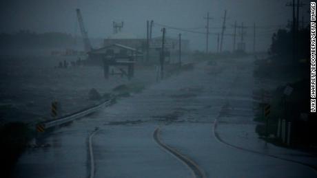
    Storm surge and strong winds from Hurricane Ida stopped the flow of the Mississippi River near New Orleans on Sunday and actually caused it to reverse — something the US Geological Survey says is “extremely uncommon.

    “Ida made landfall near Port Fourchon, Louisiana, early Sunday afternoon as an extremely dangerous Category 4 hurricane with winds of 150 mph, the National Hurricane Center (NHC) said.

  • All of New Orleans loses power

    All of New Orleans loses power

    All Orleans Parish customers without power due to “catastrophic transmission damage,” according to Entergy New Orleans.

    A company spokesperson said the storm had caused a “load imbalance to the company’s transmission and generation” and that Entergy is “making every effort to identify and rectify.”

    Now focus is on flooding and also the pumps in the Big Easy..

  • Hurricane Ida makes landfall.. gas prices nationwide set to increase

    Hurricane Ida makes landfall.. gas prices nationwide set to increase

    More than 95% of the Gulf of Mexico’s oil production has been shut down thanks to Hurricane Ida, regulators said Sunday, indicating the hurricane is having a significant impact on energy supply.  

    As of 11:30 a.m. CT, personnel have been evacuated from a total of 288 oil-and-gas production platforms, according to the Bureau of Safety and Environmental Enforcement. That represents about 51% of the manned platforms in the Gulf of Mexico.

    The agency said all 11 rigs in the Gulf of Mexico have also been evacuated, and a total of 1.7 million barrels of daily oil production in the Gulf of Mexico has been shut-in – the equivalent to 95.7% of the region’s total output. 
    — Read on www.cnn.com/us/live-news/hurricane-ida-updates-08-29-21/

    Ida has made landfall in Port Fouchon just about exact time the 16th anniversary of Katrina..

    Gas prices, as in 2005, are expected to immensely soar as a result of Ida ..

  • Ida unleashes hell

    Ida unleashes hell

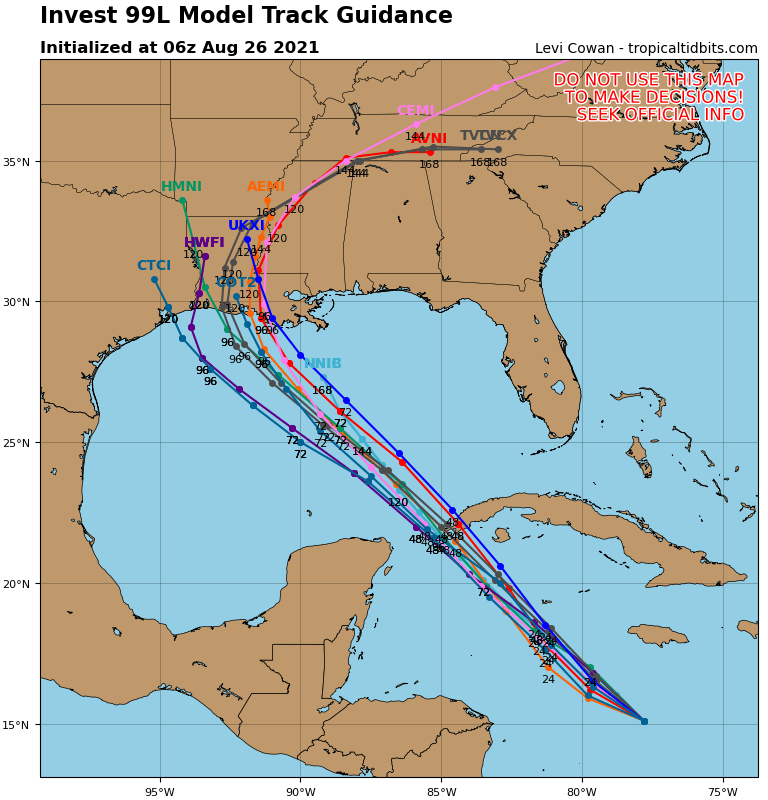
    BREAKING: HURRICANE IDA FORECAST TO PRODUCE RECORD BREAKING STORM.SURGE IN PORTIONS OF LOUISIANA.

    A lethal 12-16′ storm surge is now forecast to impact portions of Louisiana…while 2 feet or more of rain is expected to fall.

    Ida will likely go into the record books as the worst storm to hit Louisiana and one of the most violent hurricanes to.ever hit the U.S.

    There are already countless reports of power outages, and other effects from Ida even before landfall at this hour.

  • Hurricane Ida Heads to Louisiana with Epic Storm Surge, Massive Floods, & Destructive Winds.. scary warning from NHC

    Hurricane Ida Heads to Louisiana with Epic Storm Surge, Massive Floods, & Destructive Winds.. scary warning from NHC

    Destructive category 4 or greater strength winds are likely, bringing about  devastating impacts across portions of Southeast Louisiana mainly along and to the west of the I-55 corridor including metro Baton Rouge, western portions of metro New Orleans, and the Houma metropolitan area. In this area, the National Weather Service warns of structural damage to sturdy buildings, some with complete roof
    and wall failures. The National Weather Service says there will be complete destruction of mobile homes. Damage to all structures will be greatly accentuated by large airborne projectiles.  There will be thousands of  large trees snapped or uprooted along with fences and
    roadway signs blown over; many roads will be impassable from large debris, and more within urban or heavily wooded places. Many bridges, causeways, and access routes could be impassable for an extended period of time. The wind will also knock-out power and communication for weeks, months, or longer for some.
    — Read on weatherboy.com/hurricane-ida-heads-to-louisiana-with-epic-storm-surge-massive-floods-destructive-winds/

  • CATASTROPHE LOOMING FOR GULF COAST

    CATASTROPHE LOOMING FOR GULF COAST

    This is beginning to be a striking similarity to Hurricane Katrina–if not worse..16 years to the exact date of when the storm struck New Orleans..

    THE LATEST WEATHER WARNING FROM NHC:

    WTNT24 KNHC 272041
    TCMAT4
    
    HURRICANE IDA FORECAST/ADVISORY NUMBER   6
    NWS NATIONAL HURRICANE CENTER MIAMI FL       AL092021
    2100 UTC FRI AUG 27 2021
    
    CHANGES IN WATCHES AND WARNINGS WITH THIS ADVISORY...
    
    A STORM SURGE WARNING HAS BEEN ISSUED FROM EAST OF ROCKEFELLER
    WILDLIFE REFUGE LOUISIANA TO THE MISSISSIPPI/ALABAMA BORDER
    INCLUDING VERMILION BAY...LAKE BORGNE...LAKE PONTCHARTRAIN...AND
    LAKE MAUREPAS.
    
    A HURRICANE WARNING HAS BEEN ISSUED FOR THE COAST OF LOUISIANA FROM
    INTRACOASTAL CITY TO THE MOUTH OF THE PEARL RIVER...INCLUDING LAKE
    PONTCHARTRAIN...LAKE MAUREPAS...AND METROPOLITAN NEW ORLEANS.
    
    A TROPICAL STORM WARNING HAS BEEN ISSUED FOR THE NORTHERN GULF
    COAST FROM THE MOUTH OF THE PEARL RIVER TO THE MISSISSIPPI/ALABAMA
    BORDER. A TROPICAL STORM WARNING HAS ALSO BEEN ISSUED FOR THE COAST
    OF LOUISIANA FROM WEST OF INTRACOASTAL CITY TO CAMERON.
    
    SUMMARY OF WATCHES AND WARNINGS IN EFFECT...
    
    A STORM SURGE WARNING IS IN EFFECT FOR...
    * EAST OF ROCKEFELLER WILDLIFE REFUGE LOUISIANA TO THE 
    MISSISSIPPI/ALABAMA BORDER
    * VERMILION BAY...LAKE BORGNE...LAKE PONTCHARTRAIN...AND LAKE
    MAUREPAS
    
    A HURRICANE WARNING IS IN EFFECT FOR...
    * CUBAN PROVINCES OF PINAR DEL RIO AND ARTEMISA...AND THE ISLE OF
    YOUTH
    * INTRACOASTAL CITY LOUISIANA TO THE MOUTH OF THE PEARL RIVER
    * LAKE PONTCHARTRAIN...LAKE MAUREPAS...AND METROPOLITAN NEW ORLEANS
    
    A STORM SURGE WATCH IS IN EFFECT FOR...
    * SABINE PASS TO ROCKEFELLER WILDLIFE REFUGE LOUISIANA
    * MOBILE BAY
    
    A HURRICANE WATCH IS IN EFFECT FOR...
    * CAMERON LOUISIANA TO WEST OF INTRACOASTAL CITY LOUISIANA
    * MOUTH OF THE PEARL RIVER TO THE MISSISSIPPI/ALABAMA BORDER
    
    A TROPICAL STORM WARNING IS IN EFFECT FOR...
    * CUBAN PROVINCES OF MATANZAS...MAYABEQUE...AND HAVANA
    * CAMERON LOUISIANA TO WEST OF INTRACOASTAL CITY LOUISIANA
    * MOUTH OF THE PEARL RIVER TO THE MISSISSIPPI/ALABAMA BORDER
    
    A TROPICAL STORM WATCH IS IN EFFECT FOR...
    * MISSISSIPPI/ALABAMA BORDER TO THE ALABAMA/FLORIDA BORDER
    
    A STORM SURGE WARNING MEANS THERE IS A DANGER OF LIFE-THREATENING
    INUNDATION...FROM RISING WATER MOVING INLAND FROM THE
    COASTLINE...DURING THE NEXT 36 HOURS IN THE INDICATED LOCATIONS.
    FOR A DEPICTION OF AREAS AT RISK...PLEASE SEE THE NATIONAL WEATHER
    SERVICE STORM SURGE WATCH/WARNING GRAPHIC...AVAILABLE AT
    HURRICANES.GOV.  THIS IS A LIFE-THREATENING SITUATION.  PERSONS
    LOCATED WITHIN THESE AREAS SHOULD TAKE ALL NECESSARY ACTIONS TO
    PROTECT LIFE AND PROPERTY FROM RISING WATER AND THE POTENTIAL FOR
    OTHER DANGEROUS CONDITIONS.  PROMPTLY FOLLOW EVACUATION AND OTHER
    INSTRUCTIONS FROM LOCAL OFFICIALS.
    
    A HURRICANE WARNING MEANS THAT HURRICANE CONDITIONS ARE EXPECTED
    SOMEWHERE WITHIN THE WARNING AREA.  A WARNING IS TYPICALLY ISSUED
    36 HOURS BEFORE THE ANTICIPATED FIRST OCCURRENCE OF
    TROPICAL-STORM-FORCE WINDS...CONDITIONS THAT MAKE OUTSIDE
    PREPARATIONS DIFFICULT OR DANGEROUS.  PREPARATIONS TO PROTECT LIFE
    AND PROPERTY SHOULD BE RUSHED TO COMPLETION.
    
    A TROPICAL STORM WARNING MEANS THAT TROPICAL STORM CONDITIONS ARE
    EXPECTED SOMEWHERE WITHIN THE WARNING AREA WITHIN 36 HOURS.
    
    A STORM SURGE WATCH MEANS THERE IS A POSSIBILITY OF LIFE-
    THREATENING INUNDATION...FROM RISING WATER MOVING INLAND FROM THE
    COASTLINE...IN THE INDICATED LOCATIONS DURING THE NEXT 48 HOURS.
    
    A HURRICANE WATCH MEANS THAT HURRICANE CONDITIONS ARE POSSIBLE
    WITHIN THE WATCH AREA.  A WATCH IS TYPICALLY ISSUED 48 HOURS
    BEFORE THE ANTICIPATED FIRST OCCURRENCE OF TROPICAL-STORM-FORCE
    WINDS...CONDITIONS THAT MAKE OUTSIDE PREPARATIONS DIFFICULT OR
    DANGEROUS.
    
    A TROPICAL STORM WATCH MEANS THAT TROPICAL STORM CONDITIONS ARE
    POSSIBLE WITHIN THE WATCH AREA...GENERALLY WITHIN 48 HOURS.
    
    INTERESTS ELSEWHERE ALONG THE NORTHERN U.S. GULF COAST SHOULD
    MONITOR THE PROGRESS OF THIS SYSTEM.  INTERESTS IN THE DRY TORTUGAS
    SHOULD ALSO MONITOR THE PROGRESS OF IDA.
    
    HURRICANE CENTER LOCATED NEAR 22.1N  83.2W AT 27/2100Z
    POSITION ACCURATE WITHIN  20 NM
    
    PRESENT MOVEMENT TOWARD THE NORTHWEST OR 320 DEGREES AT  13 KT
    
    ESTIMATED MINIMUM CENTRAL PRESSURE  985 MB
    MAX SUSTAINED WINDS  70 KT WITH GUSTS TO  85 KT.
    64 KT....... 20NE   0SE   0SW   0NW.
    50 KT....... 40NE  30SE   0SW  20NW.
    34 KT....... 80NE  60SE  40SW  60NW.
    12 FT SEAS..  0NE 120SE  45SW   0NW.
    WINDS AND SEAS VARY GREATLY IN EACH QUADRANT.  RADII IN NAUTICAL
    MILES ARE THE LARGEST RADII EXPECTED ANYWHERE IN THAT QUADRANT.
    
    REPEAT...CENTER LOCATED NEAR 22.1N  83.2W AT 27/2100Z
    AT 27/1800Z CENTER WAS LOCATED NEAR 21.6N  82.7W
    
    FORECAST VALID 28/0600Z 23.5N  84.8W
    MAX WIND  85 KT...GUSTS 105 KT.
    64 KT... 20NE  15SE  10SW  20NW.
    50 KT... 40NE  30SE  20SW  40NW.
    34 KT...100NE  80SE  50SW  90NW.
    
    FORECAST VALID 28/1800Z 25.3N  86.9W
    MAX WIND 105 KT...GUSTS 130 KT.
    64 KT... 20NE  20SE  15SW  20NW.
    50 KT... 40NE  40SE  30SW  40NW.
    34 KT...110NE  90SE  60SW 100NW.
    
    FORECAST VALID 29/0600Z 27.1N  89.0W
    MAX WIND 115 KT...GUSTS 140 KT.
    64 KT... 30NE  25SE  20SW  30NW.
    50 KT... 50NE  50SE  30SW  50NW.
    34 KT...130NE 100SE  70SW 110NW.
    
    FORECAST VALID 29/1800Z 28.6N  90.6W
    MAX WIND 120 KT...GUSTS 145 KT.
    64 KT... 30NE  25SE  20SW  25NW.
    50 KT... 50NE  50SE  40SW  40NW.
    34 KT...120NE 110SE  70SW  90NW.
    
    FORECAST VALID 30/0600Z 30.0N  91.3W...INLAND
    MAX WIND  80 KT...GUSTS 100 KT.
    50 KT... 40NE  40SE  30SW  20NW.
    34 KT...100NE 100SE  60SW  70NW.
    
    FORECAST VALID 30/1800Z 31.5N  91.1W...INLAND
    MAX WIND  40 KT...GUSTS  50 KT.
    34 KT... 50NE  90SE  30SW  30NW.
    
    EXTENDED OUTLOOK. NOTE...ERRORS FOR TRACK HAVE AVERAGED NEAR 150 NM
    ON DAY 4 AND 175 NM ON DAY 5...AND FOR INTENSITY NEAR 15 KT EACH DAY
    
    OUTLOOK VALID 31/1800Z 34.4N  89.3W...INLAND
    MAX WIND  30 KT...GUSTS  40 KT.
    
    OUTLOOK VALID 01/1800Z 36.0N  86.0W...POST-TROP/REMNT LOW
    MAX WIND  20 KT...GUSTS  30 KT.
    
    REQUEST FOR 3 HOURLY SHIP REPORTS WITHIN 300 MILES OF 22.1N  83.2W
    
    INTERMEDIATE PUBLIC ADVISORY...WTNT34 KNHC/MIATCPAT4...AT 28/0000Z
    
    NEXT ADVISORY AT 28/0300Z
    
    $$
    FORECASTER BROWN
    
  • Henri cuts short COVID concert in NYC during Barry Manilow song

    Henri cuts short COVID concert in NYC during Barry Manilow song

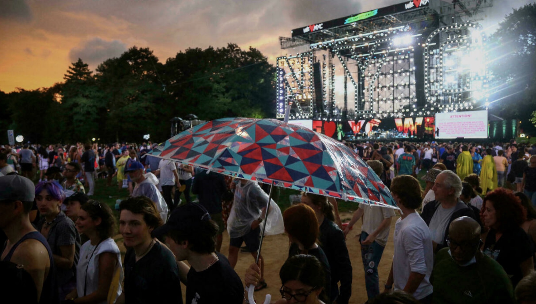
    New York City‘s Central Park was canceled because of dangerous weather as Hurricane Henri approached the Northeast on Saturday.

    The venue was billed as a vaccinated party in the USA celebrating the defeat of COVID.. Planned in advance, the timing seemed to be curious now that astronomical case counts are being realized again.

    Also with Delta rampant, some questioned if it should even happy to begin with.

    Planners fought through the controversy, but had another issue: Hurricane Henri..

    SEEK SHELTER

    Barry Manilow began performing “Can’t Smile Without You,” as part of a medley of his hits when the announcement interrupted his performance, ordering concertgoers to immediately leave the park and seek shelter. The singer continued on, not realizing at first what was happening.

    Organizers repeated over a public address for concertgoers to “calmly move to the nearest exits and proceed to areas outside of the park.”

    CNN was among those who heavily hyped this event.

    The event, which was aired exclusively on CNN, was produced by music executive Clive Davis in coordination with the city of New York and Live Nation. The coverage began with a preshow hosted by Anderson Cooper at 4 p.m. ET, with the concert kicking off at 5 p.m.

    And the show came to a screeching halt due to a hurricane..

  • HORROR HENRI!

    HORROR HENRI!

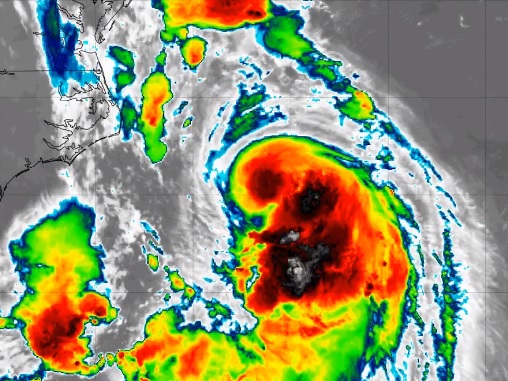
    Henri has been upgraded from Tropical Storm to Hurricane..

    The monster storm is moving over very warm waters now and the latest satellite loop shows more intensification underway, with Henri expected to be a hurricane before making landfall on central Long Island tomorrow.

    In addition to getting stronger, it is also getting larger.

    When it strikes Long Island, Henri is forecast to be over 250 miles wide.

    Long Island is 120 miles x 23 miles.

    Hurricane Hunter aircraft is investigating the storm now to get meteorologists more data on the structure of this significant storm.

    x x x

    A hurricane warning for the southern coast of New England was extended east to the west of Westport, Massachusetts. A tropical storm warning for the coast of Massachusetts is extended to Chatham. Other existing warnings and watches remain in effect.

    The last major threat of a hurricane strike on New England was more than 30 years ago.

    The last time a hurricane made landfall on parts of New England was Hurricane Bob in 1991 which resulted in 17 deaths and $1.5 billion in damage. Long Island hasn’t had a direct hit from a hurricane since Gloria in 1985. That hurricane caused eight deaths and nearly $1 billion in damage.

  • NEW YORK CITY EMERGENCY MANAGEMENT PREPARES FOR HENRI HIT

    NEW YORK CITY EMERGENCY MANAGEMENT PREPARES FOR HENRI HIT

    THE FOLLOWING IS A FULL STATEMENT FROM NEW YORK CITY EMERGENCY MANAGEMENT IN PREPARATION FOR POTENTIAL NEAR OR DIRECT STRIKE FROM EITHER TROPICAL STORM OF HURRICANE HENRI.. DEPENDING ON STRENGTH AND PATH.. DEVELOPING…

    X X X X

    FOR IMMEDIATE RELEASE#43-21

    NYC EMERGENCY MANAGEMENT URGES NEW YORKERS TO PREPARE FOR POSSIBLE IMPACTS OF TROPICAL STORM HENRI

    The National Weather Service has issued a Tropical Storm Watch for NYC until further notice

    The National Weather Service has issued a Storm Surge Watch for the Bronx and Northern Queens until further notice

    Heavy rains and gusty winds could limit visibility and create difficult travel conditions into Monday

    New York City beaches closed for swimming on Sunday and Monday

    August 20, 2021 – The New York City Emergency Management Department urges New Yorkers to prepare for potential impacts of Tropical Storm Henri. According to the National Weather Service, there is the potential for very heavy rainfall and damaging winds that may flood roadways and reduce visibility to create hazardous travel conditions through the weekend. Storm impacts are forecast to begin late Saturday, before intensifying throughout Sunday into the afternoon. Residual impacts including showers with breezy winds will still be possible into Monday. The National Weather Service has issued a Tropical Storm Watch for the New York City area until further notice. A Tropical Storm Watch is issued 48 hours in advance of the possible onset of tropical-storm-force winds, which include sustained wind speeds of 39 mph to 74 mph.  


    A Storm Surge Watch also is in effect for parts of New York City including the Bronx and northern Queens until further notice. The combination of strong winds, dangerous storm surge and the tide may cause normally dry areas to be flooded by rising waters moving inland from the shoreline within the next 48 hours. New York City beaches will be closed for swimming on Sunday and Monday.


    “Tropical Storm Henri is currently tracking up the northeast coast and may cause dangerous conditions throughout the weekend. NYC Emergency Management is working closely with City, state, and nonprofit and private-sector partners so we can respond to any impacts caused by the incoming storm,” said NYC Emergency Management Commissioner John Scrivani. “Though the storm is not expected to make direct landfall, New Yorkers should prepare for heavy rain, strong winds, and localized coastal flooding beginning as early as Saturday evening. Practice caution and avoid unnecessary travel. If you must travel, consider taking public transportation.”
    New Yorkers should plan for difficult travel conditions and are advised to exercise caution and consider taking public transportation if they must travel. Those who can stay home during the storm are advised to stay indoors. Heavy rains may lead to potential flooding in low-lying areas throughout the city. If you are traveling, avoid flooded areas, turn on headlights, drive slowly, and exercise caution. Consider avoiding or delaying travel until flooding and heavy rain stop. Due to the hazardous travel conditions, people should allow extra travel time.
    NYC Emergency Management remains in constant communication with the National Hurricane Center and the National Weather Service to track and monitor Tropical Storm Henri and has taken several steps to prepare for potential impacts to the city. The City’s Emergency Operation Center and Situation Room have been activated, and NYC Emergency Management has coordinated daily interagency conference calls to facilitate preparations with City and state agencies, as well as nonprofit and private-sector partners. The City’s Flash Flood Emergency Plan has been activated to help mitigate potential flash flooding and ensure a quick, effective, and coordinated response to any flash flood events that do occur. The City’s Downed Tree Task Force has also been put on alert to coordinate the response to any potential large downed tree event.Safety Tips

    • If you live in a flood-prone area, keep materials, such as sandbags, plywood, plastic sheeting, and lumber on hand to help protect your home. 
    • If you have a disability or access or functional need, make sure your plan addresses how your needs may affect your ability to evacuate, shelter in place, or communicate with emergency workers. Arrange help from family, friends, or service providers if you will need assistance.
    • When outside, avoid walking and driving through flooded areas. As few as six inches of moving water can knock a person over. Six inches of water will reach the bottom of most passenger cars, causing loss of control and possible stalling. One or two feet of water can carry away a vehicle.
    • Stay out of any building if it is surrounded by floodwaters.
    • If you see downed electrical wires, do not go near them. Never attempt to move or touch them with any object. Be mindful that tree limbs, leaves, or water can cover downed wires from view. Always stay away from downed power lines because they could be live.
    • Report downed wires immediately. If a power line falls on your car while you are in it, stay inside the vehicle and wait for emergency personnel.

    Power Outages

    • To prepare for a possible power outage, charge cell phone batteries, gather supplies, and turn your refrigerator and freezer to a colder setting. If you lose power, items that need refrigeration will stay cooler for longer.
    • Make sure your flashlights and any battery-operated radios or televisions are working. Keep extra batteries.
    • If you lose power and have a disability, access and functional needs or use life-sustaining equipment (LSE) and need immediate assistance, dial 911.
    • Do not use generators indoors.
    • Check on friends, relatives, and neighbors, especially older adults and people with disabilities, access and functional needs, or health conditions. Help them to prepare if needed.

    Prepare For Strong Winds Strong winds can bring down trees and power lines and can turn unsecured objects into dangerous projectiles. To protect against the hazard of strong winds, New Yorkers should:

    • Check the area immediately surrounding your home for unsecured objects or potentially dangerous conditions. Tree limbs, garbage cans, yard debris, or other materials that can be moved by the wind are potential projectiles aimed at your home or parked vehicle.
    • Bring inside loose, lightweight objects such as lawn furniture, potted plants, garbage cans, garden tools and toys.
    • Anchor objects that would be unsafe outside, such as gas grills or propane tanks.
    • Close up and secure patio furniture.
    • Secure retractable awnings.
    • Remove aerial antennas and satellite television dishes.

    Stay Informed Before, during, and after an emergency, the City will send emergency alerts and updates to New Yorkers through various channels, including Notify NYC, the City’s free, official emergency communications program. Sign up for Notify NYC to receive free emergency alerts and updates in your preferred language. Register for free to receive by visiting NYC.gov/NotifyNYC, calling 311 (212-639-9675 for Video Relay Service, or TTY: 212-504-4115), following @NotifyNYC on Twitter, or getting the free Notify NYC mobile application for your Apple or Android device.
    -30-
    MEDIA CONTACT:           Press Office: press@oem.nyc.gov (718) 422-4888
    STAY CONNECTED:        Twitter:           @NotifyNYC (emergency notifications); @nycemergencymgt (emergency preparedness info); Facebook:        /NYCemergencymanagement