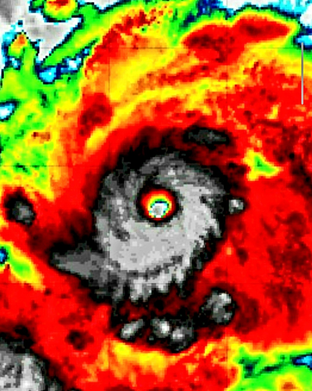
Hurricane Erin on Saturday strengthened into a fearsome Category 5 hurricane with sustained winds of 160 mph as the storm traveled west over the Atlantic, according to the National Hurricane Center.
And 200 mph gusts…
This could go down in history as one of the strongest storms ever in the Atlantic. At this point, there are some observations of a slight wobble to the south and west, and that needs to be monitored pretty closely because the track still has the storm quickly taking a sharp northern turn and out to sea, avoiding all land and Bermuda. Let’s hope the fish enjoy Hurricane Erin, and we don’t.
In the meantime, any deviation to the path could create obstacles for landfall or at least beaches. But let’s hope the current track stays exactly like it is, and we don’t have to worry about Hurricane Erin making its own weather pattern due to its strength. Everyone will be watching this one closely.
And if nothing happens, as we predict it will not based off of the current forecasts, it does offer a cautionary tale. Hurricanes are very strong this time of year in a very hot Atlantic Ocean, and this could portend trouble eventually for the Northeast—areas that have not seen the impacts of a Category 4 or 5 storm in our lifetime.